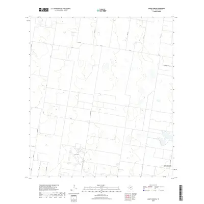
2019 Map of Monte Christo
USGS Topo · Published 2019About this map
The agricultural grid of the Rio Grande Valley stretches across this portion of Hidalgo County, dominated by the northwestern expansion of McAllen and the significant installation of Moore Field. The landscape is defined by its rectilinear road system, with family-named routes such as Kutzer Rd, Kamien Rd, and Zimmer Rd providing access to local ranchlands and citrus groves. The presence of Macnormans Grove Rd hints at the area's horticultural heritage. In the southwestern quadrant, the transition from rural acreage to denser development is evident near N Doffing Rd and the 12 Mile Line. This survey serves as a modern record of land division and infrastructure in one of Texas's most rapidly evolving border regions.
Find a feature on this map
20 named features on this map. Tap any name to fly to it.
Don’t see what you’re looking for? This feature index may not catch every label — zoom into the map to look around manually.
Map Details
Editions of this 2019 Monte Christo Map
This is the sole edition of this map. No revisions or reprints were ever made.
Other maps of this area

1939 · Linn
USGS Topo · 1:62,500

1939 · La Reforma
USGS Topo · 1:62,500

1940 · Monte Christo
USGS Topo · 1:62,500

1949 · Mc Allen
USGS Topo · 1:250,000

1954 · McAllen
USGS Topo · 1:250,000

1957 · Mc Allen
USGS Topo · 1:250,000

1962 · McAllen
USGS Topo · 1:250,000

1963 · Monte Christo
USGS Topo · 1:24,000

1963 · Edinburg
USGS Topo · 1:24,000
1963 · Faysvillle
USGS Topo · 1:24,000