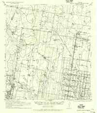
1940 Map of Monte Christo
USGS Topo · Published 1956About this map
Large cattle ranches and early irrigation efforts define this survey of the Rio Grande Valley, where family-named holdings like Javaline Ranch and Capatosa Ranch span the divide between Starr and Hidalgo counties. The transition from ranching to intensive agriculture is evident in the southeast, where a grid of canal-lined roads, such as Mile 10 Road and 3 Mile Road, feeds off the Reno Canal and Bryan Canal. This network supports the emerging community of Palmhurst and the Experimental Farm, signaling the region's mid-century shift toward commercial citrus and vegetable farming.
Find a feature on this map
54 named features on this map. Tap any name to fly to it.
Don’t see what you’re looking for? This feature index may not catch every label — zoom into the map to look around manually.
Map Details
Editions of this 1940 Monte Christo Map
2 editions found
Other maps of this area

1914 · San Juan
USGS Topo · 1:48,000

1916 · San Juan
USGS Topo · 1:62,500

1938 · Sal Colorada
USGS Topo · 1:62,500

1939 · Linn
USGS Topo · 1:62,500

1939 · La Reforma
USGS Topo · 1:62,500

1940 · Monte Christo
USGS Topo · 1:62,500

1949 · Mc Allen
USGS Topo · 1:250,000

1954 · McAllen
USGS Topo · 1:250,000

1956 · Garcias
USGS Topo · 1:62,500

1956 · Los Ebanos
USGS Topo · 1:62,500