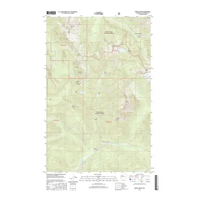
2017 Map of Monte Cristo
USGS Topo · Published 2017About this map
Monte Cristo sits high in the North Cascades, a landmark of Washington mining history situated at the junction of Glacier Cr and the S Fork Sauk River. By 2017, the terrain here is defined by the high peaks of the Mount Baker National Forest and Snoqualmie National Forest, including Del Campo Peak and Gothic Peak. The map shows a landscape of sharp relief, where the Monte Cristo Trl and Index-Galena Rd provide the primary access through steep drainages like Seventysix Gulch and Lake Gulch. To the south, the settlement of Galena marks the confluence where the North Fork Skykomish River begins. This survey illustrates the intricate drainage patterns of the region, from Sunday Falls to the high alpine waters of Foggy Lake and Silver Lake, documenting the geography of a storied district once central to the state's mineral extraction.
Find a feature on this map
70 named features on this map. Tap any name to fly to it.
Don’t see what you’re looking for? This feature index may not catch every label — zoom into the map to look around manually.
Map Details
Editions of this 2017 Monte Cristo Map
This is the sole edition of this map. No revisions or reprints were ever made.
Other maps of this area

1899 · Glacier Peak
USGS Topo · 1:125,000

1899 · Stillaguamish
USGS Topo · 1:125,000

1901 · Glacier Peak
USGS Topo · 1:125,000

1901 · Stilaguamish
USGS Topo · 1:125,000

1902 · Skykomish
USGS Topo · 1:125,000

1905 · Skykomish
USGS Topo · 1:125,000

1921 · Sultan
USGS Topo · 1:125,000

1923 · Sultan
USGS Topo · 1:125,000

1955 · Concrete
USGS Topo · 1:250,000

1957 · Silverton
USGS Topo · 1:62,500