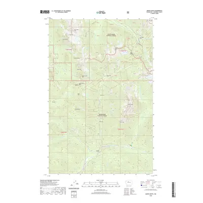
2020 Map of Monte Cristo
USGS Topo · Published 2020About this map
Galena sits at the convergence of mountain drainages in this high-altitude survey of the Cascades. The landscape is defined by the meeting of the Mount Baker National Forest and Snoqualmie National Forest, creating a region of extreme vertical relief. From the prominent Silvertip Peak and Gothic Peak down to the headwaters of the North Fork Skykomish River, the map documents the drainage patterns of Silver Creek and Canyon Creek. Notable high-country landmarks include Poodle Dog Pass and the remote Glacier Basin, illustrating the challenging geography of the Snohomish County backcountry. The presence of numerous mining-era labels like Seventysix Gulch and Mineral Butte points to the historical extraction efforts that once drew people to these steep ridges, while named features such as Del Campo Peak and Foggy Pass remain significant for modern navigation and mountain travel.
Find a feature on this map
70 named features on this map. Tap any name to fly to it.
Don’t see what you’re looking for? This feature index may not catch every label — zoom into the map to look around manually.
Map Details
Editions of this 2020 Monte Cristo Map
This is the sole edition of this map. No revisions or reprints were ever made.
Other maps of this area

1899 · Glacier Peak
USGS Topo · 1:125,000

1899 · Stillaguamish
USGS Topo · 1:125,000

1901 · Glacier Peak
USGS Topo · 1:125,000

1901 · Stilaguamish
USGS Topo · 1:125,000

1902 · Skykomish
USGS Topo · 1:125,000

1905 · Skykomish
USGS Topo · 1:125,000

1921 · Sultan
USGS Topo · 1:125,000

1923 · Sultan
USGS Topo · 1:125,000

1955 · Concrete
USGS Topo · 1:250,000

1957 · Silverton
USGS Topo · 1:62,500