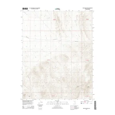
2014 Map of Monte Mountain
USGS Topo · Published 2014About this map
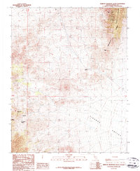
Monte Mountain and the Timpahute Range dominate this high-desert landscape in Lincoln County, where water sources are the primary landmarks for navigation. Numerous scattered springs, including Wheat Grass Spring, White Bluff Spring, and Coyote Spring, suggest a network of seasonal water critical to local movement across the basin and range. Human presence is defined by primitive routes like Tempiute Mine Rd, which leads toward the steep slopes near Chocolate Drop, and Penoyer Spring Rd traversing the northern flats. The southern portion of the sheet is marked by Schofield Pass, a natural corridor through the higher elevations. These labels indicate an area shaped by the requirements of early mineral prospecting and ranching, where remote outposts relied on specific reliable hydrology like The Seeps and Wild Horse Spring.
Find a feature on this map
21 named features on this map. Tap any name to fly to it.
Don’t see what you’re looking for? This feature index may not catch every label — zoom into the map to look around manually.
Map Details
Editions of this 2014 Monte Mountain Map
This is the sole edition of this map. No revisions or reprints were ever made.
Other maps of this area

1942 · Penoyer Valley
USGS Topo · 1:125,000

1954 · Caliente
USGS Topo · 1:250,000

1959 · Caliente
USGS Topo · 1:250,000

1964 · Tempiute Mtn
USGS Topo · 1:62,500
1985 · Mount Irish
USGS Topo · 1:24,000
1985 · Crescent Spring
USGS Topo · 1:24,000

1985 · Murphy Gap
USGS Topo · 1:24,000

1985 · Worthington Peak SW
USGS Topo · 1:24,000
1985 · Meeker Peak
USGS Topo · 1:24,000
1987 · Tempiute Mountain South
USGS Topo · 1:24,000