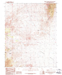
1987 Map of Tempiute Mountain South
USGS Topo · Published 1987About this map
Tikaboo Valley and the southern reaches of the Timpahute Range dominate this 1980s landscape, illustrating a high-desert environment defined by strategic water sources and mineral extraction. The map records several vital water points, including Old Tikaboo Spring and the curiously named April Fool Spring, which served as essential landmarks for prospectors and travelers in this arid terrain.
Find a feature on this map
16 named features on this map. Tap any name to fly to it.
Don’t see what you’re looking for? This feature index may not catch every label — zoom into the map to look around manually.
Map Details
Editions of this 1987 Tempiute Mountain South Map
This is the sole edition of this map. No revisions or reprints were ever made.
Other maps of this area

1942 · Emigrant Valley
USGS Topo · 1:125,000

1942 · Penoyer Valley
USGS Topo · 1:125,000

1952 · White Blotch Springs
USGS Topo · 1:62,500

1952 · Groom Mine
USGS Topo · 1:62,500

1954 · Caliente
USGS Topo · 1:250,000

1959 · Caliente
USGS Topo · 1:250,000

1964 · Tempiute Mtn
USGS Topo · 1:62,500
1983 · Groom Range NE
USGS Topo · 1:24,000

1985 · Pahranagat Range
USGS Topo · 1:100,000
1987 · Tempiute Mountain North
USGS Topo · 1:24,000