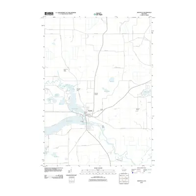
2010 Map of Montello
USGS Topo · Published 2010About this map
Montello is defined by its relationship with water and stone, situated at the confluence of the Montello River and the Fox River. The city is bifurcated by the expansive Buffalo Lake and Lake Montello, which are regulated by the Montello Dam and the Montello Granite Dam. The presence of the Montello Granite Quarry at the heart of the settlement points to the area's geological industrial heritage, while the surrounding landscape is dotted with numerous kettle lakes such as Kilby Lake, Echo Lake, and Moon Lake. This 2010 survey also highlights several private aviation sites, including the Snow Crest Ranch Airport and the Sky Lodge Landing Strip, scattered across the agricultural and woodland tracts. Researchers will find local genealogy well-represented at Saint John the Baptist Cemetery and Eastside Cemetery, both located along the corridors leading out of the central town site.
Find a feature on this map
61 named features on this map. Tap any name to fly to it.
Don’t see what you’re looking for? This feature index may not catch every label — zoom into the map to look around manually.
Map Details
Editions of this 2010 Montello Map
This is the sole edition of this map. No revisions or reprints were ever made.
Other maps of this area

1902 · Portage
USGS Topo · 1:62,500

1915 · Neshkoro
USGS Topo · 1:48,000

1918 · Neshkoro
USGS Topo · 1:62,500

1955 · Randolph
USGS Topo · 1:62,500

1957 · Madison
USGS Topo · 1:250,000

1960 · Madison
USGS Topo · 1:250,000

1961 · Montello
USGS Topo · 1:62,500

1962 · Portage
USGS Topo · 1:62,500

1963 · Neshkoro
USGS Topo · 1:62,500
1980 · Marquette
USGS Topo · 1:24,000