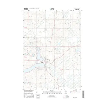
2016 Map of Montello
USGS Topo · Published 2016About this map
Montello serves as the central hub of this Wisconsin landscape, situated at the junction where the Montello River flows into the expansive Buffalo Lake. The town's layout is defined by its proximity to water, with Lake Montello to the north and the winding course of the Fox River passing through the eastern portion of the quadrangle. This 2016 survey illustrates a region characterized by a high density of glacial lakes and wetlands, including Echo Lake, Kilby Lake, and Mud Lake. Local history and genealogy interests are anchored by the Saint John the Baptist Cem and Eastside Cem, which mark the community's established roots. The northern terrain features the Snow Crest Ranch Airport, while the surrounding rural landscape is interlaced with a grid of county roads such as Co RD J and Co RD Y, supporting a mix of agricultural land and scattered residential development.
Find a feature on this map
82 named features on this map. Tap any name to fly to it.
Don’t see what you’re looking for? This feature index may not catch every label — zoom into the map to look around manually.
Map Details
Editions of this 2016 Montello Map
This is the sole edition of this map. No revisions or reprints were ever made.
Other maps of this area

1902 · Portage
USGS Topo · 1:62,500

1915 · Neshkoro
USGS Topo · 1:48,000

1918 · Neshkoro
USGS Topo · 1:62,500

1955 · Randolph
USGS Topo · 1:62,500

1957 · Madison
USGS Topo · 1:250,000

1960 · Madison
USGS Topo · 1:250,000

1961 · Montello
USGS Topo · 1:62,500

1962 · Portage
USGS Topo · 1:62,500

1963 · Neshkoro
USGS Topo · 1:62,500
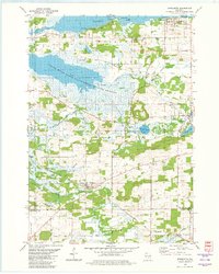
1980 · Marquette
USGS Topo · 1:24,000