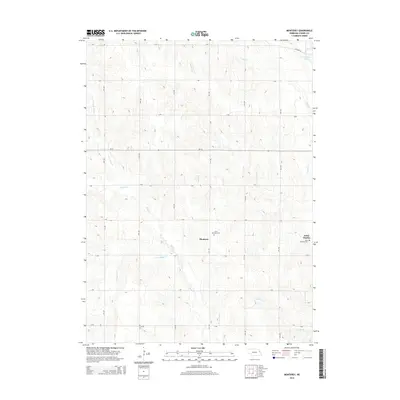
2014 Map of Monterey
USGS Topo · Published 2014About this map
Monterey serves as a central hub in this section of Cuming County, characterized by a meticulously planned grid of rural roads and rolling agricultural land. The settlement pattern is defined by the intersection of north-south and east-west routes, such as 11th Rd and F Rd, which connect scattered homesteads to local spiritual and community centers. Religious history is anchored by Saint Boniface Cem near Monterey and Saint Anthony Cem in the neighboring settlement of Saint Charles. The landscape is deeply influenced by the dendritic drainage of the Pebble Creek system, including N Br Pebble Cr and S Br Pebble Cr. To the northeast, the presence of McKirahan Lake near the confluence of Fisher Cr provides a notable hydrologic landmark in an otherwise intensely farmed prairie environment.
Find a feature on this map
26 named features on this map. Tap any name to fly to it.
Don’t see what you’re looking for? This feature index may not catch every label — zoom into the map to look around manually.
Map Details
Editions of this 2014 Monterey Map
This is the sole edition of this map. No revisions or reprints were ever made.
Other maps of this area

1955 · Fremont
USGS Topo · 1:250,000

1957 · Fremont
USGS Topo · 1:250,000

1958 · Fremont
USGS Topo · 1:250,000

1963 · Wisner
USGS Topo · 1:24,000

1966 · West Point NW
USGS Topo · 1:24,000

1966 · Monterey
USGS Topo · 1:24,000
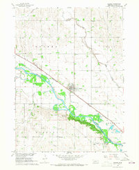
1966 · Beemer
USGS Topo · 1:24,000

1966 · Snyder
USGS Topo · 1:24,000

1966 · Aloys
USGS Topo · 1:24,000

1966 · Scribner
USGS Topo · 1:24,000