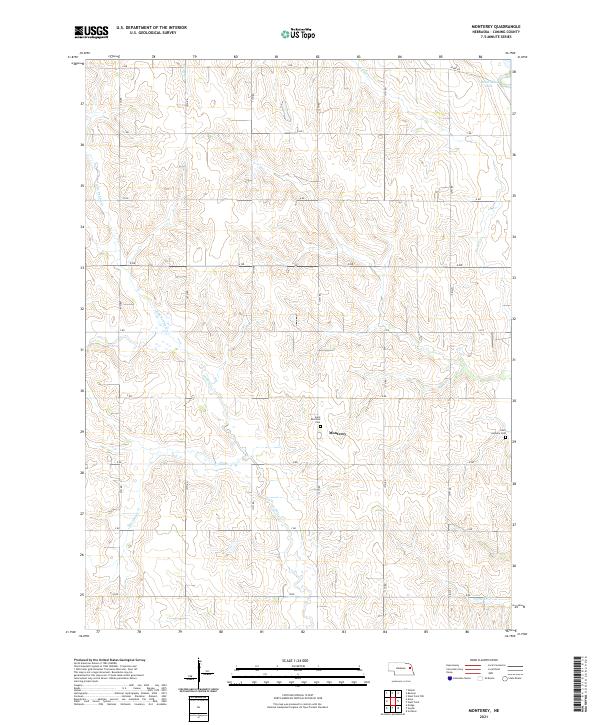
2021 Map of Monterey
USGS Topo · Published 2021About this map
Monterey serves as the focal point of this rural Cuming County landscape, situated amidst the complex drainage systems of the Elkhorn River basin. The geography is defined by the branching tributaries of Pebble Cr, including the N Br Pebble Cr and S Br Pebble Cr, which carve through the agricultural sections. This survey provides vital data for genealogists, as it identifies the location of Saint Boniface Cem near the center of the township and Saint Anthony Cem to the southeast. To the north, McKirahan Lake and Fisher Cr mark the transition toward the river valley, while a strictly rectangular grid of section roads, labeled from A RD through J RD, organizes the prairie into the productive farmsteads characteristic of the region.
Find a feature on this map
23 named features on this map. Tap any name to fly to it.
Don’t see what you’re looking for? This feature index may not catch every label — zoom into the map to look around manually.
Map Details
Editions of this 2021 Monterey Map
This is the sole edition of this map. No revisions or reprints were ever made.
Other maps of this area

1955 · Fremont
USGS Topo · 1:250,000

1957 · Fremont
USGS Topo · 1:250,000

1958 · Fremont
USGS Topo · 1:250,000

1963 · Wisner
USGS Topo · 1:24,000

1966 · West Point NW
USGS Topo · 1:24,000

1966 · Monterey
USGS Topo · 1:24,000
1966 · Beemer
USGS Topo · 1:24,000

1966 · Snyder
USGS Topo · 1:24,000

1966 · Aloys
USGS Topo · 1:24,000

1966 · Scribner
USGS Topo · 1:24,000