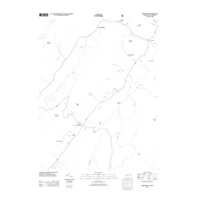
2013 Map of Monterey
USGS Topo · Published 2013About this map
The town of Monterey serves as the central hub of this Highland County landscape, where the convergence of Us-220 and Us-250 anchors a network of mountain roads. The terrain is defined by high ridges like Lantz Mountain and Monterey Mountain that channel the headwaters of the S Br Potomac River and Strait Cr. This 2013 survey illustrates a rural Appalachian pattern of narrow valley settlements, including New Hampden and Possum Trot, where family-named landmarks such as Trimble Knob and Miracle Ridge break the high elevation. Distinctive local features like Hannah Field Airport and the tiny alleyways of Sieg Aly and Mill Aly in the village center offer precise details for those studying the modern footprint of these long-established mountain communities. The hydrology is particularly intricate here, with numerous runs like Burners Run and Crab Run feeding the larger creek systems that define the area's geography.
Find a feature on this map
59 named features on this map. Tap any name to fly to it.
Don’t see what you’re looking for? This feature index may not catch every label — zoom into the map to look around manually.
Map Details
Editions of this 2013 Monterey Map
This is the sole edition of this map. No revisions or reprints were ever made.
Other maps of this area

1889 · Beverly
USGS Topo · 1:125,000

1892 · Beverly
USGS Topo · 1:125,000

1892 · Franklin
USGS Topo · 1:125,000

1894 · Staunton
USGS Topo · 1:125,000

1896 · Franklin
USGS Topo · 1:125,000

1901 · Monterey
USGS Topo · 1:125,000

1922 · Spruce Knob
USGS Topo · 1:48,000

1922 · Circleville
USGS Topo · 1:62,500

1924 · Circleville
USGS Topo · 1:48,000

1924 · Mc Dowell
USGS Topo · 1:62,500