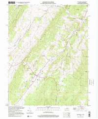
1999 Map of Monterey
USGS Topo · Published 2001About this map
Monterey serves as the focal point for this Highland County landscape, where the settlement pattern follows the narrow valleys carved between prominent ridges. The geography is defined by the steep parallel rises of Lantz Mountain, Monterey Mountain, and Jack Mountain, which channel the Potomac River and its numerous tributaries like Strait Creek and Crab Run. Smaller communities and landmarks are scattered throughout these corridors, including New Hampden and Possum Trot, reflecting a rural Highlands economy based on small-scale agriculture and timber, further evidenced by a Quarry and the George Washington National Forest boundary.
Find a feature on this map
42 named features on this map. Tap any name to fly to it.
Don’t see what you’re looking for? This feature index may not catch every label — zoom into the map to look around manually.
Map Details
Editions of this 1999 Monterey Map
This is the sole edition of this map. No revisions or reprints were ever made.
Other maps of this area

1889 · Beverly
USGS Topo · 1:125,000

1892 · Beverly
USGS Topo · 1:125,000

1892 · Franklin
USGS Topo · 1:125,000

1894 · Staunton
USGS Topo · 1:125,000

1896 · Franklin
USGS Topo · 1:125,000

1901 · Monterey
USGS Topo · 1:125,000

1922 · Spruce Knob
USGS Topo · 1:48,000

1922 · Circleville
USGS Topo · 1:62,500

1924 · Circleville
USGS Topo · 1:48,000

1924 · Mc Dowell
USGS Topo · 1:62,500