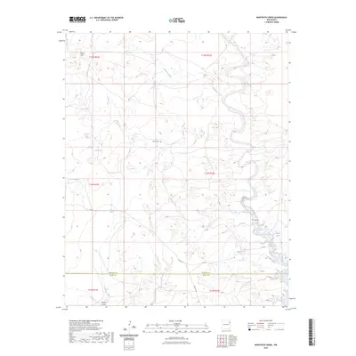
2023 Map of Montesito Creek
USGS Topo · Published 2023About this map
Montesito Creek winds through the high plains of northeastern New Mexico, defining a landscape marked by the critical presence of water in an arid environment. This territory along the Harding Co Quay Co line reflects a history of ranching and remote settlement, where isolated water sources like Alamosa Spring, Bootlegger Spring, and Dripping Springs served as essential landmarks for movement across the basin. The Gravel Hills rise to the northwest, providing a textured backdrop to the sparse road network that includes Trigg Rd and Co Rd C. For local historians and genealogists, the map preserves the locations of the Alamosa Cem and Vigil Cem, which stand as quiet markers of the families who established themselves in this section of the Llano Estacado. The presence of Dry Tank and Pit Tank further illustrates the practical engineering required to sustain life and livestock in this corner of New Mexico.
Find a feature on this map
24 named features on this map. Tap any name to fly to it.
Don’t see what you’re looking for? This feature index may not catch every label — zoom into the map to look around manually.
Map Details
Editions of this 2023 Montesito Creek Map
This is the sole edition of this map. No revisions or reprints were ever made.
Other maps of this area

1930 · Tucumcari
USGS Topo · 1:125,000

1954 · Tucumcari
USGS Topo · 1:250,000

1958 · Tucumcari
USGS Topo · 1:250,000

1962 · Logan
USGS Topo · 1:62,500

1966 · Mc Carty Ranch
USGS Topo · 1:24,000

1968 · Bascom Camp
USGS Topo · 1:24,000

1968 · Hampton Ranch
USGS Topo · 1:24,000

1968 · Hudson
USGS Topo · 1:24,000

1968 · Montesito Creek
USGS Topo · 1:24,000

1969 · Gallegos
USGS Topo · 1:24,000