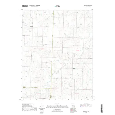
2017 Map of Montevallo
USGS Topo · Published 2017About this map
Montevallo and the surrounding rural communities of Olympia, Osiris, and Jerico Springs define this corner of Missouri where Vernon, Cedar, and Barton counties meet. The landscape is structured by a network of creeks including Horse Creek, Stinking Cr, and Cynthia Cr, which have historically dictated the placement of farms and cemeteries across the townships. Genealogists will find interest in several established burial grounds such as Walnut Grove Cem, Oldham Cem, and Brasher Cem, which serve as landmarks for the area's ancestral families. The map details a transition from the rolling drainage basins of Jordan Cr and Maples Br to the higher ground marked by long-standing county roads like Co Rd E and E Veteran Rd, illustrating how early settlement patterns were influenced by the proximity to reliable water and the essential routes connecting these dispersed hamlets.
Find a feature on this map
80 named features on this map. Tap any name to fly to it.
Don’t see what you’re looking for? This feature index may not catch every label — zoom into the map to look around manually.
Map Details
Editions of this 2017 Montevallo Map
This is the sole edition of this map. No revisions or reprints were ever made.
Other maps of this area

1886 · Nevada
USGS Topo · 1:125,000

1886 · Stockton
USGS Topo · 1:125,000

1894 · Nevada
USGS Topo · 1:125,000

1939 · Dederick
USGS Topo · 1:24,000

1939 · Filley
USGS Topo · 1:24,000

1939 · Eldorado Springs South
USGS Topo · 1:24,000

1940 · Filley
USGS Topo · 1:24,000
1942 · Dederick
USGS Topo · 1:24,000
1942 · Eldorado Springs South
USGS Topo · 1:24,000

1947 · Joplin
USGS Topo · 1:250,000