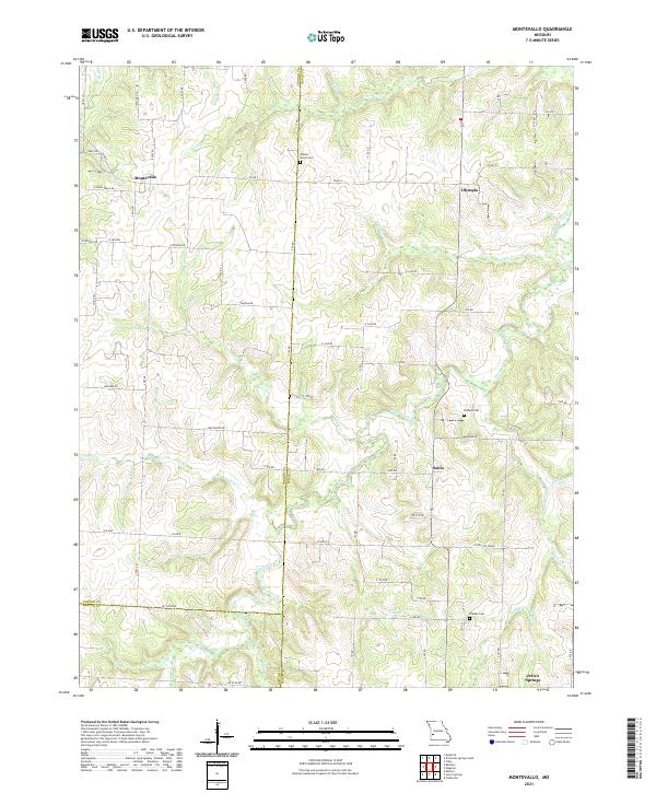
2021 Map of Montevallo
USGS Topo · Published 2021About this map
Montevallo and Jerico Springs anchor this corner of southwest Missouri, where the boundaries of Vernon, Cedar, and Barton Counties converge. The landscape is defined by an intricate network of waterways, including the winding Stinking Cr and Horse Creek, which carve through the rural countryside. Small, historic community centers like Olympia and Osiris are connected by a grid of county roads such as Veteran Rd and Weltmer Rd. Local history is preserved in several family and community burial grounds, most notably Walnut Grove Cem near the Cedar County line and Brasher Cem further south. The drainage patterns of Cynthia Cr and Mulberry Cr illustrate the undulating terrain of the region, reflecting a land use primarily dedicated to agriculture and small-scale settlement near the Ozark plateau's western edge.
Find a feature on this map
71 named features on this map. Tap any name to fly to it.
Don’t see what you’re looking for? This feature index may not catch every label — zoom into the map to look around manually.
Map Details
Editions of this 2021 Montevallo Map
This is the sole edition of this map. No revisions or reprints were ever made.
Other maps of this area

1886 · Nevada
USGS Topo · 1:125,000

1886 · Stockton
USGS Topo · 1:125,000

1894 · Nevada
USGS Topo · 1:125,000

1939 · Dederick
USGS Topo · 1:24,000

1939 · Filley
USGS Topo · 1:24,000

1939 · Eldorado Springs South
USGS Topo · 1:24,000

1940 · Filley
USGS Topo · 1:24,000
1942 · Dederick
USGS Topo · 1:24,000
1942 · Eldorado Springs South
USGS Topo · 1:24,000

1947 · Joplin
USGS Topo · 1:250,000