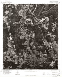
1975 Map of Montevallo NE
USGS Topo · Published 1977About this map
Alabaster serves as the northern anchor for this orthophotoquad, showing the city's residential and industrial footprint during the mid-1970s. This aerial imagery provides a direct look at the cleared landscapes and development patterns along the central corridor, where the town of Saginaw is situated amidst a mix of forested tracts and active resource extraction sites. The visual data captured by the U.S. Geological Survey in cooperation with the Soil Conservation Service reveals the practical geography of the region, from the cluster of buildings at Dogwood to the large-scale land disturbances that characterize the local industry of the era. This perspective is particularly useful for understanding how the highway and rail networks influenced the expansion of these Shelby County communities before modern suburban sprawl reshaped the terrain.
Find a feature on this map
3 named features on this map. Tap any name to fly to it.
Don’t see what you’re looking for? This feature index may not catch every label — zoom into the map to look around manually.
Map Details
Editions of this 1975 Montevallo NE Map
This is the sole edition of this map. No revisions or reprints were ever made.
Other maps of this area

1890 · Bessemer
USGS Topo · 1:125,000

1892 · Bessemer
USGS Topo · 1:125,000

1905 · Bessemer Iron District
USGS Topo · 1:62,500

1906 · Vandiver
USGS Topo · 1:62,500

1907 · Bessemer Special
USGS Topo · 1:62,500

1908 · Vandiver
USGS Topo · 1:62,500

1909 · Columbiana
USGS Topo · 1:62,500

1910 · Montevallo
USGS Topo · 1:62,500

1911 · Columbiana
USGS Topo · 1:62,500

1953 · Birmingham
USGS Topo · 1:250,000