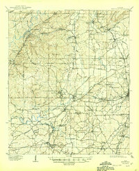
1910 Map of Montevallo
USGS Topo · Published 1944About this map
Montevallo serves as the central hub of this Central Alabama landscape during the first decade of the twentieth century, anchored by the Southern Ry and the Louisville and Nashville RR networks. The region is defined by its industrial transition, evidenced by the Superior Mine and the structural remains of Bibb Furnace (Ruins) near Brierfield. These features reflect an era when iron production and coal mining were shifting the local economy away from purely agrarian roots.
Find a feature on this map
95 named features on this map. Tap any name to fly to it.
Don’t see what you’re looking for? This feature index may not catch every label — zoom into the map to look around manually.
Map Details
Editions of this 1910 Montevallo Map
4 editions found
Other maps of this area

1890 · Bessemer
USGS Topo · 1:125,000

1891 · Clanton
USGS Topo · 1:125,000

1892 · Bessemer
USGS Topo · 1:125,000

1899 · Brookwood
USGS Topo · 1:125,000

1905 · Bessemer Iron District
USGS Topo · 1:62,500

1906 · Vandiver
USGS Topo · 1:62,500

1907 · Bessemer Special
USGS Topo · 1:62,500

1908 · Vandiver
USGS Topo · 1:62,500

1909 · Columbiana
USGS Topo · 1:62,500

1910 · Montevallo
USGS Topo · 1:62,500