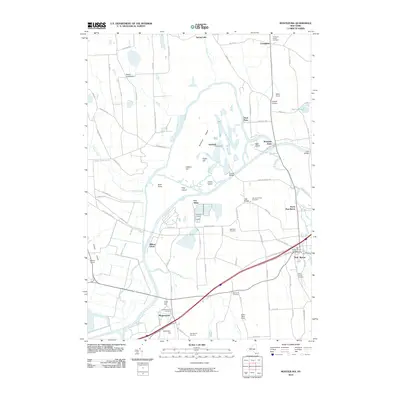
2010 Map of Montezuma
USGS Topo · Published 2010About this map
The Seneca River and the historic Erie Canal dominate this landscape in central New York, reflecting a legacy of water-based transport that continues to shape the region. The village of Montezuma sits at the nexus of these waterways, surrounded by the extensive Montezuma marshlands and distinctive landforms like Howland Island and Emerson Hill. This map provides significant value for genealogists, documenting several family-named burial sites including the Stevens Family Cemetery, Wethy Family Cemetery, and the McCloud Cemetery. The settlement pattern follows older routes, with clusters at Port Byron, Cottage Corners, and Rogers Crossroads. The landscape transitions from the watery lowlands of the Crusoe Creek to the upland farms of Miller Farms and Mills Dairy Farm, illustrating the traditional intersection of canal-era infrastructure and agricultural life.
Find a feature on this map
93 named features on this map. Tap any name to fly to it.
Don’t see what you’re looking for? This feature index may not catch every label — zoom into the map to look around manually.
Map Details
Editions of this 2010 Montezuma Map
This is the sole edition of this map. No revisions or reprints were ever made.
Other maps of this area

1899 · Auburn
USGS Topo · 1:62,500

1902 · Geneva
USGS Topo · 1:62,500

1902 · Clyde
USGS Topo · 1:62,500

1902 · Weedsport
USGS Topo · 1:62,500

1902 · Auburn
USGS Topo · 1:62,500

1943 · Montezuma
USGS Topo · 1:31,680

1943 · Cayuga
USGS Topo · 1:31,680

1943 · Cato
USGS Topo · 1:31,680

1943 · Savannah
USGS Topo · 1:31,680

1943 · Weedsport
USGS Topo · 1:31,680