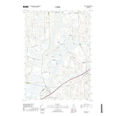
2019 Map of Montezuma
USGS Topo · Published 2019About this map
The Montezuma Marsh dominates this landscape, illustrating the complex intersection of New York's natural wetlands and its historic transportation corridors. The Seneca River winds through the center of the sheet, surrounded by distinctive glacial features like Howland Island, Hog Island, and Camel Island. The legacy of the 19th-century canal era is evident along the southern edge, where the Erie Canal passes through the village of Montezuma. Further east, Port Byron serves as a significant hub for both road and rail, with the New York Central RD and several major routes converging near the Owasco River. For genealogists, the map preserves the locations of several small burial grounds, including the Stevens Family Cem and the Old Montezuma Cem, which are key to tracing early families in Cayuga and Seneca Counties.
Find a feature on this map
108 named features on this map. Tap any name to fly to it.
Don’t see what you’re looking for? This feature index may not catch every label — zoom into the map to look around manually.
Map Details
Editions of this 2019 Montezuma Map
This is the sole edition of this map. No revisions or reprints were ever made.
Other maps of this area

1899 · Auburn
USGS Topo · 1:62,500

1902 · Geneva
USGS Topo · 1:62,500

1902 · Clyde
USGS Topo · 1:62,500

1902 · Weedsport
USGS Topo · 1:62,500

1902 · Auburn
USGS Topo · 1:62,500

1943 · Montezuma
USGS Topo · 1:31,680

1943 · Cayuga
USGS Topo · 1:31,680

1943 · Cato
USGS Topo · 1:31,680

1943 · Savannah
USGS Topo · 1:31,680

1943 · Weedsport
USGS Topo · 1:31,680