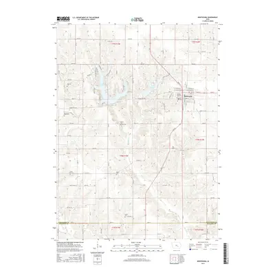
2015 Map of Montezuma
USGS Topo · Published 2015About this map
Montezuma serves as the focal point of this Poweshiek County landscape, centered around its traditional grid of streets like Main St and Front St. The town is flanked by significant local water bodies, including the sprawling Lake Ponderosa to the west and the more compact Diamond Lake to the east. The surrounding countryside is a study in rural cemetery distribution, preserving the names of early family and community burial grounds such as McDonald Cem, McCoy Cem, and Bone Cem.
Find a feature on this map
70 named features on this map. Tap any name to fly to it.
Don’t see what you’re looking for? This feature index may not catch every label — zoom into the map to look around manually.
Map Details
Editions of this 2015 Montezuma Map
This is the sole edition of this map. No revisions or reprints were ever made.
Other maps of this area

1954 · Des Moines
USGS Topo · 1:250,000

1956 · Des Moines
USGS Topo · 1:250,000

1957 · Des Moines
USGS Topo · 1:250,000

1965 · Gibson
USGS Topo · 1:24,000

1968 · Brooklyn
USGS Topo · 1:24,000

1968 · Barnes City
USGS Topo · 1:24,000

1969 · Des Moines
USGS Topo · 1:250,000

1979 · Montezuma
USGS Topo · 1:24,000

1979 · Searsboro
USGS Topo · 1:24,000

1979 · Grinnell South
USGS Topo · 1:24,000