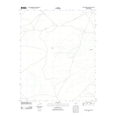
2011 Map of Montezumas Chair
USGS Topo · Published 2011About this map
Montezumas Chair rises as a prominent landmark in this high-desert portion of the Navajo Nation within Navajo County. The landscape is defined by its sparse but critical water sources, including Honey Spring in the northeast and the centrally located Little Water. This modern topographic survey illustrates the enduring importance of tribal infrastructure, specifically the network of Bureau of Indian Affairs routes like Indian Rte-9901 and Indian Rte-6820 that facilitate movement across the arid plateau. The drainages and seasonal watercourses shown here underscore the geographic challenges of the region, providing a detailed look at the drainage patterns that surround the distinctive landform of the quadrangle's namesake.
Find a feature on this map
6 named features on this map. Tap any name to fly to it.
Don’t see what you’re looking for? This feature index may not catch every label — zoom into the map to look around manually.
Map Details
Editions of this 2011 Montezumas Chair Map
This is the sole edition of this map. No revisions or reprints were ever made.
Other maps of this area

1883 · Tusayan
USGS Topo · 1:250,000

1886 · Tusayan
USGS Topo · 1:250,000

1947 · Flagstaff
USGS Topo · 1:250,000

1954 · Flagstaff
USGS Topo · 1:250,000

1957 · Winslow 1 SW
USGS Topo · 1:24,000

1958 · Flagstaff
USGS Topo · 1:250,000

1960 · Flagstaff
USGS Topo · 1:250,000

1962 · Flagstaff
USGS Topo · 1:250,000

1966 · Egloffstein Butte
USGS Topo · 1:62,500

1966 · Tovar Mesa
USGS Topo · 1:62,500