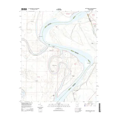
2014 Map of Montgomery Island
USGS Topo · Published 2014About this map
The Mississippi River meanders across the border of Arkansas and Mississippi in this 2014 survey, defining a landscape shaped by shifting channels and historical sediment deposits. Montgomery Island and Montgomery Towhead sit at the center of a dramatic loop, surrounded by evidence of the river's hydrologic history such as the Montgomery Cutoff and Old River Lake. Near the southern edge of the sheet, Terrene Landing serves as a focal point for local river access, situated just north of the Rosedale Cem.
Find a feature on this map
46 named features on this map. Tap any name to fly to it.
Don’t see what you’re looking for? This feature index may not catch every label — zoom into the map to look around manually.
Map Details
Editions of this 2014 Montgomery Island Map
This is the sole edition of this map. No revisions or reprints were ever made.
Other maps of this area

1930 · Mellwood
USGS Topo · 1:62,500

1939 · Henrico
USGS Topo · 1:62,500

1939 · Pace
USGS Topo · 1:62,500

1939 · Big Island
USGS Topo · 1:62,500

1939 · Mellwood
USGS Topo · 1:62,500

1948 · Helena
USGS Topo · 1:250,000

1950 · Helena
USGS Topo · 1:250,000

1953 · Greenwood
USGS Topo · 1:250,000

1954 · Mellwood
USGS Topo · 1:62,500

1954 · Henrico
USGS Topo · 1:62,500