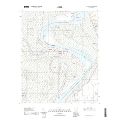
2020 Map of Montgomery Island
USGS Topo · Published 2020About this map
The Mississippi River creates a complex landscape of shifting borders and landforms along the Arkansas-Mississippi state line in this 2020 record. Central to this stretch is Montgomery Island, a significant landmass bounded by the river's main channel and the Montgomery Cutoff. This area is defined by the hydrologic evolution of the river, where former channels have left behind features like Coono Brake and Jackson Bend. On the Mississippi side, the floodplain is managed by the Levee Rd, protecting areas near Rosedale Cem and Terrene Landing Rd. The terrain is scattered with oxbows and backwaters, including Old Tar Paper Shack Lake and Swan Deer Lake, reflecting the region's character as a dynamic riparian environment used for recreation and agriculture.
Find a feature on this map
47 named features on this map. Tap any name to fly to it.
Don’t see what you’re looking for? This feature index may not catch every label — zoom into the map to look around manually.
Map Details
Editions of this 2020 Montgomery Island Map
This is the sole edition of this map. No revisions or reprints were ever made.
Other maps of this area

1930 · Mellwood
USGS Topo · 1:62,500

1939 · Henrico
USGS Topo · 1:62,500

1939 · Pace
USGS Topo · 1:62,500

1939 · Big Island
USGS Topo · 1:62,500

1939 · Mellwood
USGS Topo · 1:62,500

1948 · Helena
USGS Topo · 1:250,000

1950 · Helena
USGS Topo · 1:250,000

1953 · Greenwood
USGS Topo · 1:250,000

1954 · Mellwood
USGS Topo · 1:62,500

1954 · Henrico
USGS Topo · 1:62,500