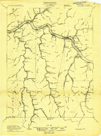
1908 Map of Montgomery
USGS Topo · Published 1908About this map
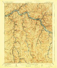
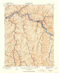
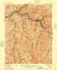
Kanawha River coal and transportation networks dominate this 1908 survey, where the river valley serves as a critical corridor for the Chesapeake and Ohio Railroad and the Kanawha and Michigan Division. The settlement pattern is strictly dictated by the narrow valley floors, with industrial towns like Montgomery, Handley, and Cannelton anchored between steep ridges and the water. Navigation infrastructure is evident through Lock No 2, Lock No 3, and Lock No 4, which managed the river's flow for heavy barge traffic. Inland, the map reveals a series of tributary-hollow settlements such as Carbondale, Marting, and Sharon, showing how mining and timber operations pushed deep into the surrounding terrain. Notable geographic features like the Wheeler Islands and high points such as Payne Knob provide landmarks for researchers tracing the early 20th-century industrial development of the Kanawha and Fayette county borders.
Find a feature on this map
159 named features on this map. Tap any name to fly to it.
Don’t see what you’re looking for? This feature index may not catch every label — zoom into the map to look around manually.
Map Details
Editions of this 1908 Montgomery Map
This is the sole edition of this map. No revisions or reprints were ever made.
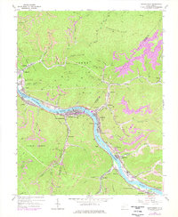
Historical Maps of Montgomery Through Time
8 maps found