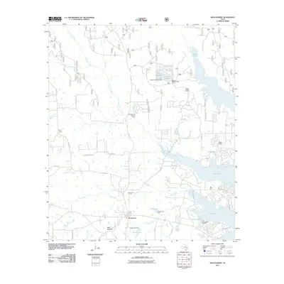
2010 Map of Montgomery
USGS Topo · Published 2010About this map
Montgomery Cemetery and the Peel Cabin anchor this 2010 survey of Montgomery, Texas, showing a landscape defined by significant water management and suburban growth. The sheet is dominated by numerous small reservoirs and impoundments, including Lake Paula, Stewart Lake, and Lake Mount Pleasant, each with their respective dams like the Cape Conroe Dam Number 1. These water bodies are fed by a complex drainage system featuring Town Creek, Atkins Creek, and Stewart Creek.
Find a feature on this map
40 named features on this map. Tap any name to fly to it.
Don’t see what you’re looking for? This feature index may not catch every label — zoom into the map to look around manually.
Map Details
Editions of this 2010 Montgomery Map
This is the sole edition of this map. No revisions or reprints were ever made.
Other maps of this area

1954 · Beaumont
USGS Topo · 1:250,000

1957 · Beaumont
USGS Topo · 1:250,000

1958 · Cowl Spur
USGS Topo · 1:24,000

1958 · Lake Paula
USGS Topo · 1:24,000

1959 · Moore Grove
USGS Topo · 1:24,000

1959 · San Jacinto
USGS Topo · 1:24,000

1959 · Montgomery
USGS Topo · 1:24,000

1962 · Keenan
USGS Topo · 1:24,000

1962 · Dacus
USGS Topo · 1:24,000

1962 · Plantersville
USGS Topo · 1:24,000