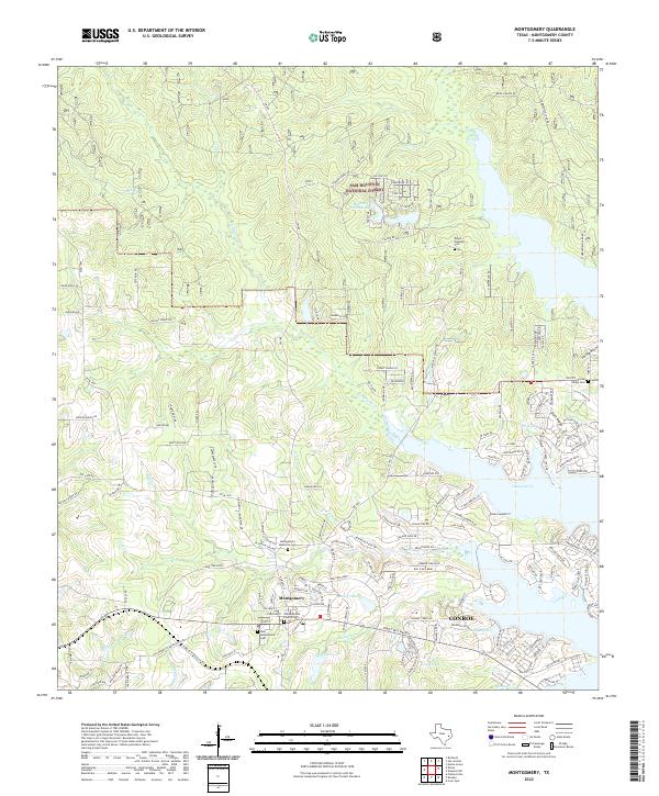
2022 Map of Montgomery
USGS Topo · Published 2022About this map
Montgomery serves as the focal point of this Montgomery County landscape, where the historic core is anchored by the Old Methodist Church and several burial grounds including Montgomery Memorial Cem and New Montgomery Cem. The topography is defined by the expansive woodlands of the Sam Houston National Forest to the north and the jagged western shoreline of Lake Conroe to the east. Modern residential developments such as those along Grand Harbor Blvd and Bentwater Dr W contrast with the traditional land use patterns of the Piney Woods. Water remains a central element of the terrain, from the sprawling reach of Stewart Lake and Rampy Lake near the town center to the remote reaches of Hidden Forest Lake and the natural drainages of Atkins Cr and Little Lake Cr.
Find a feature on this map
158 named features on this map. Tap any name to fly to it.
Don’t see what you’re looking for? This feature index may not catch every label — zoom into the map to look around manually.
Map Details
Editions of this 2022 Montgomery Map
This is the sole edition of this map. No revisions or reprints were ever made.
Other maps of this area

1954 · Beaumont
USGS Topo · 1:250,000

1957 · Beaumont
USGS Topo · 1:250,000

1958 · Cowl Spur
USGS Topo · 1:24,000

1958 · Lake Paula
USGS Topo · 1:24,000

1959 · Moore Grove
USGS Topo · 1:24,000

1959 · San Jacinto
USGS Topo · 1:24,000

1959 · Montgomery
USGS Topo · 1:24,000

1962 · Keenan
USGS Topo · 1:24,000

1962 · Dacus
USGS Topo · 1:24,000

1962 · Plantersville
USGS Topo · 1:24,000