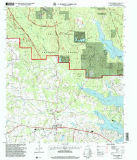
1997 Map of Montgomery
USGS Topo · Published 2000About this map
The historic town of Montgomery serves as the focal point for this late-20th-century survey, which details the interface between long-established settlements and the extensive Sam Houston National Forest. The landscape is a mix of small rural communities and significant water features, dominated by the eastern shoreline of Lake Conroe. Local history is preserved through landmarks such as Lincoln Sch, China Chapel, and the Mount Pleasant Cemetery, reflecting the social and educational fabric of this Texas county seat before the rapid expansion of the Houston metropolitan area reached its borders.
Find a feature on this map
38 named features on this map. Tap any name to fly to it.
Don’t see what you’re looking for? This feature index may not catch every label — zoom into the map to look around manually.
Map Details
Editions of this 1997 Montgomery Map
This is the sole edition of this map. No revisions or reprints were ever made.
Other maps of this area

1954 · Beaumont
USGS Topo · 1:250,000

1957 · Beaumont
USGS Topo · 1:250,000

1958 · Cowl Spur
USGS Topo · 1:24,000

1958 · Lake Paula
USGS Topo · 1:24,000

1959 · Moore Grove
USGS Topo · 1:24,000

1959 · San Jacinto
USGS Topo · 1:24,000

1959 · Montgomery
USGS Topo · 1:24,000

1962 · Keenan
USGS Topo · 1:24,000

1962 · Dacus
USGS Topo · 1:24,000

1962 · Plantersville
USGS Topo · 1:24,000