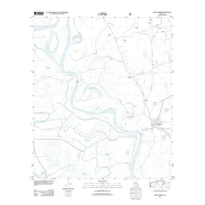
2012 Map of Montgomery
USGS Topo · Published 2012About this map
Red River meanders through this portion of Grant Parish, defining a landscape of oxbow lakes, bayous, and floodplain settlements. The town of Montgomery serves as a primary hub on the eastern bank, supported by nearby communities like Boley, Kadesh, and Crews. The river’s influence on the geography is evident in the numerous water bodies that mirror its winding path, including Cane River Lake, Saint Maurice Lake, and Dunn Lake.
Find a feature on this map
79 named features on this map. Tap any name to fly to it.
Don’t see what you’re looking for? This feature index may not catch every label — zoom into the map to look around manually.
Map Details
Editions of this 2012 Montgomery Map
This is the sole edition of this map. No revisions or reprints were ever made.
Other maps of this area

1935 · Verda
USGS Topo · 1:31,680

1937 · Bermuda
USGS Topo · 1:31,680

1937 · Campti SE
USGS Topo · 1:31,680

1937 · Aloha
USGS Topo · 1:31,680

1937 · Montgomery
USGS Topo · 1:62,500

1937 · Cloutierville
USGS Topo · 1:31,680

1937 · Cypress
USGS Topo · 1:31,680

1942 · Montgomery
USGS Topo · 1:62,500

1943 · Provencal
USGS Topo · 1:62,500

1944 · Campti
USGS Topo · 1:62,500