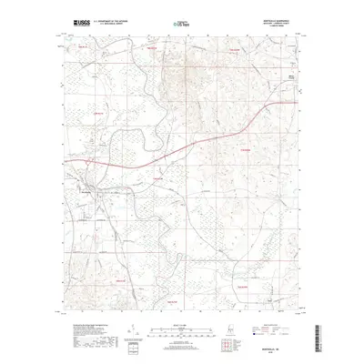
2018 Map of Monticello
USGS Topo · Published 2018About this map
Monticello sits along the western banks of the Pearl River, serving as a central hub for Lawrence County in this 2018 survey. The landscape is defined by the winding river and its many tributaries, including Fair River, Halls Cr, and Sellers Creek, which create a complex wetland environment throughout the lowlands. Local transportation is anchored by the N A Sandifer Memorial Hwy and Old Hwy 27, which connect the main settlement to outlying areas like Silver Creek and Arm.
Find a feature on this map
73 named features on this map. Tap any name to fly to it.
Don’t see what you’re looking for? This feature index may not catch every label — zoom into the map to look around manually.
Map Details
Editions of this 2018 Monticello Map
This is the sole edition of this map. No revisions or reprints were ever made.
Other maps of this area

1953 · Hattiesburg
USGS Topo · 1:250,000

1953 · Natchez
USGS Topo · 1:250,000

1956 · Natchez
USGS Topo · 1:250,000

1958 · Hattiesburg
USGS Topo · 1:250,000

1959 · Natchez
USGS Topo · 1:250,000

1970 · Prentiss West
USGS Topo · 1:24,000

1970 · Topeka
USGS Topo · 1:24,000

1970 · Monticello
USGS Topo · 1:24,000

1970 · Oak Vale
USGS Topo · 1:24,000

1970 · New Hebron
USGS Topo · 1:24,000