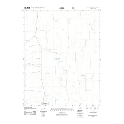
2011 Map of Monticello North
USGS Topo · Published 2011About this map
The town of Monticello anchors the southern edge of this San Juan County landscape, where the high-altitude plateau begins to break into the drainage systems of the Four Corners region. Water management is a central theme here, evidenced by the presence of Keller Reservoir and Keller Dam, which capture runoff in an arid environment defined by seasonal washes like Spring Creek and Seep Creek. The terrain is marked by distinctive geographical landmarks such as Peters Pt and Hickman Flt, while the San Juan County Airport serves as a critical infrastructure point for this corner of Utah.
Find a feature on this map
25 named features on this map. Tap any name to fly to it.
Don’t see what you’re looking for? This feature index may not catch every label — zoom into the map to look around manually.
Map Details
Editions of this 2011 Monticello North Map
This is the sole edition of this map. No revisions or reprints were ever made.
Other maps of this area

1885 · La Sal
USGS Topo · 1:250,000

1886 · Abajo
USGS Topo · 1:250,000

1892 · Abajo
USGS Topo · 1:250,000

1893 · Abajo
USGS Topo · 1:250,000

1954 · Mt Peale 3 SW
USGS Topo · 1:24,000

1954 · Mt Peale 3 SE
USGS Topo · 1:24,000

1954 · Mt Peale 4 SW
USGS Topo · 1:24,000
1954 · Lisbon Valley
USGS Topo · 1:62,500
1954 · Hatch Rock
USGS Topo · 1:62,500

1955 · Verdure 2 SE
USGS Topo · 1:24,000