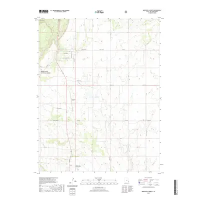
2020 Map of Monticello North
USGS Topo · Published 2020About this map
Monticello marks the southern edge of this San Juan County landscape, situated where the high plains of the Hickman Flat meet the rising slopes of the Manti-La Sal National Forest. The transition from the rugged drainage of Big Canyon and Peters Canyon in the north to the more level terrain around the Monticello Airport illustrates the diverse geography of the Colorado Plateau. Water management is central to the area's development, evidenced by the Gordon Reservoir and Keller Reservoir, which capture runoff from the Blue Mountain Ridge. This network of springs and creeks, including Peters Spring and Spring Cr, has long supported both ranching and the growth of the town. The road network, including the precisely mapped Tarb Rd and Peter Spring Rd, provides a clear view of how land access and irrigation infrastructure have shaped this high-desert community.
Find a feature on this map
33 named features on this map. Tap any name to fly to it.
Don’t see what you’re looking for? This feature index may not catch every label — zoom into the map to look around manually.
Map Details
Editions of this 2020 Monticello North Map
This is the sole edition of this map. No revisions or reprints were ever made.
Other maps of this area

1885 · La Sal
USGS Topo · 1:250,000

1886 · Abajo
USGS Topo · 1:250,000

1892 · Abajo
USGS Topo · 1:250,000

1893 · Abajo
USGS Topo · 1:250,000

1954 · Mt Peale 3 SW
USGS Topo · 1:24,000

1954 · Mt Peale 3 SE
USGS Topo · 1:24,000

1954 · Mt Peale 4 SW
USGS Topo · 1:24,000
1954 · Lisbon Valley
USGS Topo · 1:62,500
1954 · Hatch Rock
USGS Topo · 1:62,500

1955 · Verdure 2 SE
USGS Topo · 1:24,000