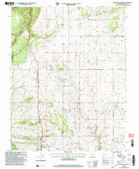
2001 Map of Monticello North
USGS Topo · Published 2004About this map
Monticello anchors the southern edge of this landscape, where the high desert plateau begins its descent into a complex system of drainage corridors. This 2001 revision, based on earlier surveys and updated imagery, reveals the infrastructure of a high-altitude county seat, including the San Juan County Airport and the nearby Rodeo Ground. The terrain is defined by dramatic erosional features like Big Canyon and Peters Canyon, which cut through the eastern reaches of the Manti-La Sal National Forest. Water management is central to this environment, evidenced by the presence of Kelley Reservoir, Peters Spring, and various aqueducts and pipelines that traverse the region. Traces of local industry and transit are found in a Gravel Pit and several storage bins, alongside the residential footprint of a Mobile Home Park on the northern outskirts of town.
Find a feature on this map
22 named features on this map. Tap any name to fly to it.
Don’t see what you’re looking for? This feature index may not catch every label — zoom into the map to look around manually.
Map Details
Editions of this 2001 Monticello North Map
This is the sole edition of this map. No revisions or reprints were ever made.
Other maps of this area

1885 · La Sal
USGS Topo · 1:250,000

1886 · Abajo
USGS Topo · 1:250,000

1892 · Abajo
USGS Topo · 1:250,000

1893 · Abajo
USGS Topo · 1:250,000

1954 · Mt Peale 3 SW
USGS Topo · 1:24,000

1954 · Mt Peale 3 SE
USGS Topo · 1:24,000

1954 · Mt Peale 4 SW
USGS Topo · 1:24,000
1954 · Lisbon Valley
USGS Topo · 1:62,500
1954 · Hatch Rock
USGS Topo · 1:62,500

1955 · Verdure 2 SE
USGS Topo · 1:24,000