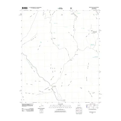
2011 Map of Monticello
USGS Topo · Published 2011About this map
Alamosa Creek flows through a landscape defined by deep canyons and early 21st-century water management, sustaining the small community of Monticello and the nearby Placitas. The Monticello Community Ditch provides a critical historical link to the traditional acequia irrigation systems of Sierra County. To the north, the Goldsborough District and the Negro Diggings reflect the area's mining heritage, with specific sites like Goldsborough 1 Mine and the Terry Prospect recorded in the terrain. For genealogists and local historians, the Monticello Cemetery and small settlements like La Petra offer focal points for tracing family roots in this high-desert environment. Numerous earthen tanks, including Bill Tank and Jolla Tank, dot the drainages of Monticello Canyon and Jose Maria Canyon, illustrating the essential nature of water storage for ranching at Red Rock Ranch.
Find a feature on this map
64 named features on this map. Tap any name to fly to it.
Don’t see what you’re looking for? This feature index may not catch every label — zoom into the map to look around manually.
Map Details
Editions of this 2011 Monticello Map
This is the sole edition of this map. No revisions or reprints were ever made.
Other maps of this area

1954 · Tularosa
USGS Topo · 1:250,000

1958 · Tularosa
USGS Topo · 1:250,000

1961 · Priest Tank
USGS Topo · 1:24,000

1961 · Huerfano Hill
USGS Topo · 1:24,000

1961 · Sierra Fijardo
USGS Topo · 1:24,000

1961 · Monticello
USGS Topo · 1:24,000

1964 · Vicks Peak
USGS Topo · 1:24,000

1964 · Montoya Butte
USGS Topo · 1:24,000

1964 · Steel Hill
USGS Topo · 1:24,000

1965 · Jaralosa Mountain
USGS Topo · 1:24,000