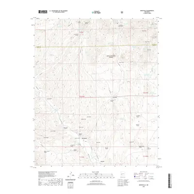
2020 Map of Monticello
USGS Topo · Published 2020About this map
Monticello and Placitas sit at the southern edge of this Sierra County landscape, where the topography transitions from the high ridges of the Cibola National Forest toward the drainage basins of Alamosa Cr. This 2020 survey records a landscape defined by its deep canyon systems and cattle tanks, reflecting the long-standing ranching history of the region. Monticello Canyon serves as a primary geographic axis, while numerous family-named landmarks such as Seferino Hill and Fifty-fifty Hill characterize the surrounding terrain. Genealogists may find particular value in the location of the Monticello Cem, situated just south of the main settlement. Further north, the map identifies smaller locales like La Petra and water sources essential to the arid environment, including Garcia Falls and Stanley Tank.
Find a feature on this map
70 named features on this map. Tap any name to fly to it.
Don’t see what you’re looking for? This feature index may not catch every label — zoom into the map to look around manually.
Map Details
Editions of this 2020 Monticello Map
This is the sole edition of this map. No revisions or reprints were ever made.
Other maps of this area

1954 · Tularosa
USGS Topo · 1:250,000

1958 · Tularosa
USGS Topo · 1:250,000

1961 · Priest Tank
USGS Topo · 1:24,000

1961 · Huerfano Hill
USGS Topo · 1:24,000

1961 · Sierra Fijardo
USGS Topo · 1:24,000

1961 · Monticello
USGS Topo · 1:24,000

1964 · Vicks Peak
USGS Topo · 1:24,000

1964 · Montoya Butte
USGS Topo · 1:24,000

1964 · Steel Hill
USGS Topo · 1:24,000

1965 · Jaralosa Mountain
USGS Topo · 1:24,000