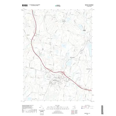
2019 Map of Monticello
USGS Topo · Published 2019About this map
Monticello serves as the focal point of this Sullivan County region, with the Sullivan County Courthouse anchored at the center of a dense street grid. The 2019 survey documents a landscape defined by its numerous recreational and seasonal water bodies, including Kiamesha Lake, Anawana Lake, and Sackett Lake. These lakes are surrounded by established residential clusters such as South Fallsburg and Hurleyville, connected by a network of regional roads like Old Rte 17. For genealogists, the map preserves the locations of several burial grounds, from the Brookside Cem in Harris to the Jewish General Aid Cem and Saint Peters Cem. The hydrography is equally intricate, with the Mongaup River and its branches, including the Middle Mongaup River, winding through the western terrain near Bushville and Maplewood.
Find a feature on this map
155 named features on this map. Tap any name to fly to it.
Don’t see what you’re looking for? This feature index may not catch every label — zoom into the map to look around manually.
Map Details
Editions of this 2019 Monticello Map
This is the sole edition of this map. No revisions or reprints were ever made.
Other maps of this area

1909 · Monticello
USGS Topo · 1:62,500

1910 · Neversink
USGS Topo · 1:62,500

1911 · Monticello
USGS Topo · 1:62,500

1921 · Livingston Manor
USGS Topo · 1:62,500

1922 · White Lake
USGS Topo · 1:62,500

1923 · Livingston Manor
USGS Topo · 1:62,500

1942 · White Lake
USGS Topo · 1:62,500

1942 · Neversink
USGS Topo · 1:62,500

1943 · White Lake
USGS Topo · 1:62,500

1943 · Monticello
USGS Topo · 1:62,500