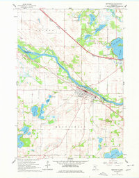
1961 Map of Monticello
USGS Topo · Published 1978About this map
The Mississippi River carves a diagonal path through this landscape, serving as the natural boundary between Sherburne and Wright counties. In the early 1960s, the community of Monticello is centered south of the river, defined by a grid that meets the Great Northern railway. North of the water, the Northern Pacific line runs through the smaller settlement of Salida and the town of Big Lake. The terrain is characterized by an immense concentration of glacial lakes, from the large expanse of Pelican Lake in the south to the cluster including Lake Mitchell and Thompson Lake in the north. Local history is anchored by sites like St Henrys Cem and Riverside Cem, while the regional infrastructure is evidenced by the Flynn Airport and numerous Gravel Pits that suggest the area's active extractive industry during this era.
Find a feature on this map
39 named features on this map. Tap any name to fly to it.
Don’t see what you’re looking for? This feature index may not catch every label — zoom into the map to look around manually.
Map Details
Editions of this 1961 Monticello Map
3 editions found

Other maps of this area

1909 · Rockford
USGS Topo · 1:62,500

1953 · Stillwater
USGS Topo · 1:250,000

1955 · Stillwater
USGS Topo · 1:250,000

1958 · Stillwater
USGS Topo · 1:250,000

1958 · Rockford
USGS Topo · 1:62,500

1958 · Buffalo
USGS Topo · 1:62,500

1961 · Clear Lake
USGS Topo · 1:24,000

1961 · Big Lake
USGS Topo · 1:24,000

1961 · Silver Creek
USGS Topo · 1:24,000

1961 · Orrock
USGS Topo · 1:24,000