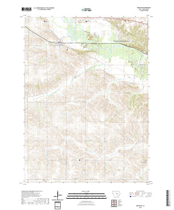
2022 Map of Montour
USGS Topo · Published 2022About this map
The Iowa River meanders across the northern portion of this landscape, carving a wide valley that defines the local geography. Just south of the river, the town of Montour sits along the historic Lincoln Hwy, a primary artery for the region. To the east, the Mesquakie Indian Settlement spans the river, showing a distinct land-use pattern within the surrounding agricultural grid. The terrain is marked by numerous small tributaries including Raven Cr, Richland Cr, and Abes Fork. Genealogists will find a significant concentration of burial sites throughout the area, from the Butlerville Cem in the northwest to the Maple Grove Cem in the southeast. These cemeteries, such as Maple Hill Cem and the McIntosh Cem, serve as important landmarks for tracing family lineages in Tama County.
Find a feature on this map
43 named features on this map. Tap any name to fly to it.
Don’t see what you’re looking for? This feature index may not catch every label — zoom into the map to look around manually.
Map Details
Editions of this 2022 Montour Map
This is the sole edition of this map. No revisions or reprints were ever made.
Other maps of this area

1954 · Waterloo
USGS Topo · 1:250,000

1954 · Des Moines
USGS Topo · 1:250,000

1955 · Waterloo
USGS Topo · 1:250,000

1956 · Des Moines
USGS Topo · 1:250,000

1957 · Des Moines
USGS Topo · 1:250,000

1960 · Marshalltown
USGS Topo · 1:62,500

1960 · Le Grand
USGS Topo · 1:24,000

1969 · Des Moines
USGS Topo · 1:250,000

1971 · Garwin
USGS Topo · 1:24,000
1971 · Gladbrook SE
USGS Topo · 1:24,000