
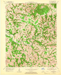
1953 Map of Montpelier
USGS Topo · Published 1955About this map
Russell Creek carves a winding path through the center of this rural landscape, serving as the primary drainage for numerous tributaries like White Oak Creek and Goose Creek. During the mid-1950s, this portion of Adair County and Russell County was characterized by a dense network of country schools and churches that anchored small farming communities. Many of these hubs, such as Montpelier and Glens Fork, featured their own dedicated schools like Montpelier Sch and Glens Fork Sch.
Find a feature on this map
72 named features on this map. Tap any name to fly to it.
Don’t see what you’re looking for? This feature index may not catch every label — zoom into the map to look around manually.
Map Details
Editions of this 1953 Montpelier Map
2 editions found
Other maps of this area

1953 · Amandaville
USGS Topo · 1:24,000

1953 · Creelsboro
USGS Topo · 1:24,000

1953 · Jamestown
USGS Topo · 1:24,000

1953 · Dunnville
USGS Topo · 1:24,000

1953 · Cane Valley
USGS Topo · 1:24,000

1954 · Knifley
USGS Topo · 1:24,000

1954 · Columbia
USGS Topo · 1:24,000

1954 · Russell Springs
USGS Topo · 1:24,000

1956 · Corbin
USGS Topo · 1:250,000

1957 · Winchester
USGS Topo · 1:250,000