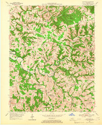
1953 Map of Montpelier
USGS Topo · Published 1966About this map
The winding course of Russell Creek dominates this mid-century topographic record, carving through the ridges of southern Adair County. The settlement at Montpelier serves as a central hub, surrounded by a dense network of country schools and churches that define the social geography of the era. To the north, Oak Grove Ridge and Craycraft Ridge rise above small farming communities like Garlin and Ozark.
Find a feature on this map
64 named features on this map. Tap any name to fly to it.
Don’t see what you’re looking for? This feature index may not catch every label — zoom into the map to look around manually.
Map Details
Editions of this 1953 Montpelier Map
2 editions found
Other maps of this area

1953 · Amandaville
USGS Topo · 1:24,000

1953 · Montpelier
USGS Topo · 1:24,000

1953 · Creelsboro
USGS Topo · 1:24,000

1953 · Jamestown
USGS Topo · 1:24,000

1953 · Dunnville
USGS Topo · 1:24,000

1953 · Cane Valley
USGS Topo · 1:24,000

1954 · Knifley
USGS Topo · 1:24,000

1954 · Columbia
USGS Topo · 1:24,000

1954 · Russell Springs
USGS Topo · 1:24,000

1956 · Corbin
USGS Topo · 1:250,000