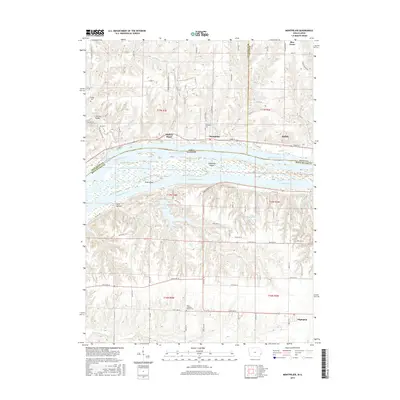
2015 Map of Montpelier
USGS Topo · Published 2015About this map
Mississippi River defines the border between Iowa and Illinois on this 2015 survey, shaping a landscape of intricate waterways and riverfront settlements. On the Iowa side, the community of Montpelier is situated near the riverbanks, north of which the land rises into the dissected plateaus of Scott and Muscatine Counties. Genealogists will find several burial grounds documented, including Dodge Cem, Nye Cem, and Montpelier Cem. Across the water in Illinois, the map transitions into the grid-patterned farmlands around Edgington, where the Zion Lutheran Church and its associated Zion Lutheran Church Cem serve as local landmarks. The river itself is characterized by a complex network of secondary channels and islands, such as Andalusia Slough, Arab Chute, and Andalusia Island, illustrating the persistent influence of the river's floodplains on regional development.
Find a feature on this map
94 named features on this map. Tap any name to fly to it.
Don’t see what you’re looking for? This feature index may not catch every label — zoom into the map to look around manually.
Map Details
Editions of this 2015 Montpelier Map
This is the sole edition of this map. No revisions or reprints were ever made.
Other maps of this area

1890 · Durant
USGS Topo · 1:62,500

1891 · Davenport
USGS Topo · 1:62,500

1894 · Durant
USGS Topo · 1:62,500

1894 · Davenport
USGS Topo · 1:62,500

1901 · Rock Island
USGS Topo · 1:125,000

1910 · Rock Island
USGS Topo · 1:125,000

1912 · Milan
USGS Topo · 1:62,500

1916 · Edgington
USGS Topo · 1:62,500

1938 · Edgington
USGS Topo · 1:62,500

1944 · Milan
USGS Topo · 1:62,500