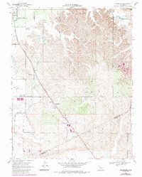
1968 Map of Montpelier
USGS Topo · Published 1987About this map
Agricultural development along the Stanislaus Co Merced Co border defines this landscape during the late 1960s. The small settlement of Montpelier serves as a focal point for the region's rural commerce, evidenced by the presence of a Grain Elevator and the prominent Radio Towers (KCEY). This era marks a transition in local transportation, as the diagonal Montpelier Road (Dismantled) indicates the removal of former rail infrastructure that once linked these valley communities.
Find a feature on this map
17 named features on this map. Tap any name to fly to it.
Don’t see what you’re looking for? This feature index may not catch every label — zoom into the map to look around manually.
Map Details
Editions of this 1968 Montpelier Map
3 editions found
Other maps of this area

1913 · Dickenson
USGS Topo · 1:31,680

1915 · Paulsell
USGS Topo · 1:31,680

1916 · Three Tree Flat
USGS Topo · 1:31,680

1916 · Cressey
USGS Topo · 1:31,680

1916 · Montpellier
USGS Topo · 1:31,680

1916 · Cooperstown
USGS Topo · 1:31,680

1916 · Denair
USGS Topo · 1:31,680

1916 · Waterford
USGS Topo · 1:31,680

1917 · Turlock
USGS Topo · 1:31,680

1917 · Winton
USGS Topo · 1:31,680