
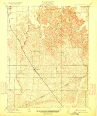
1916 Map of Montpellier
USGS Topo · Published 1916About this map
Montpellier and Hickman serve as the primary hubs in this Central Valley agricultural landscape, captured just before the first World War. The topography is defined by the early engineering of water transport, specifically the Turlock Irrigation Ditch and various other branches of Irrigation Ditch infrastructure that enabled the region's transition into a productive farming belt. These man-made channels contrast with the intricate, rolling contours of the eastern terrain, where the land rises away from the flat valley floor. The Southern Pacific (Oakdale Branch) railroad cuts a sharp diagonal through the quadrangle, providing the essential link for transporting local produce to larger markets. Along the southern edge, the Stanislaus Co Merced Co line marks the administrative divide in a region where the geography was being rapidly reshaped by irrigation and rail.
Find a feature on this map
8 named features on this map. Tap any name to fly to it.
Don’t see what you’re looking for? This feature index may not catch every label — zoom into the map to look around manually.
Map Details
Editions of this 1916 Montpellier Map
2 editions found
Other maps of this area

1913 · Dickenson
USGS Topo · 1:31,680

1915 · Paulsell
USGS Topo · 1:31,680

1916 · Three Tree Flat
USGS Topo · 1:31,680

1916 · Cressey
USGS Topo · 1:31,680

1916 · Cooperstown
USGS Topo · 1:31,680

1916 · Denair
USGS Topo · 1:31,680

1916 · Waterford
USGS Topo · 1:31,680

1917 · Turlock
USGS Topo · 1:31,680

1917 · Winton
USGS Topo · 1:31,680

1939 · Modesto East
USGS Topo · 1:62,500