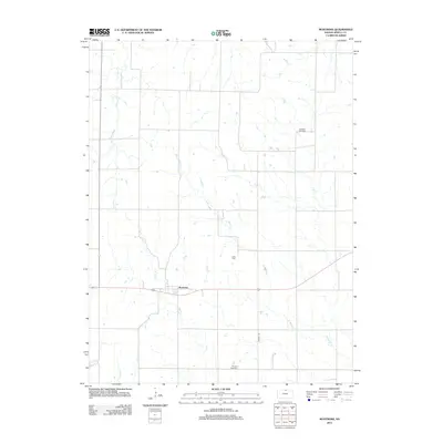
2012 Map of Montrose
USGS Topo · Published 2012About this map
Montrose sits as the central settlement in this portion of Jewell County, where the agricultural landscape is defined by the winding paths of Johns Cr and the various branches of Marsh Creek. This 2012 survey illustrates a classic Midwestern rural grid, punctuated by small community anchors that have served local families for generations. Three distinct burial grounds—Switzers Gap Cem, Delta Cem, and Pleasant View Cem—are dispersed across the township, providing essential coordinates for genealogists tracing family histories in the area. The drainage patterns of W Marsh Cr and E Marsh Cr converge toward the south, while the passage of Randall Rd provides a primary north-south artery through the rolling plains and creek valleys.
Find a feature on this map
9 named features on this map. Tap any name to fly to it.
Don’t see what you’re looking for? This feature index may not catch every label — zoom into the map to look around manually.
Map Details
Editions of this 2012 Montrose Map
This is the sole edition of this map. No revisions or reprints were ever made.
Other maps of this area

1892 · Concordia
USGS Topo · 1:125,000

1894 · Mankato
USGS Topo · 1:125,000

1955 · Manhattan
USGS Topo · 1:250,000

1955 · Beloit
USGS Topo · 1:250,000

1956 · Manhattan
USGS Topo · 1:250,000

1957 · Manhattan
USGS Topo · 1:250,000

1959 · Beloit
USGS Topo · 1:250,000
1968 · Jamestown NW
USGS Topo · 1:24,000
1969 · Randall
USGS Topo · 1:24,000

1969 · Mankato
USGS Topo · 1:24,000