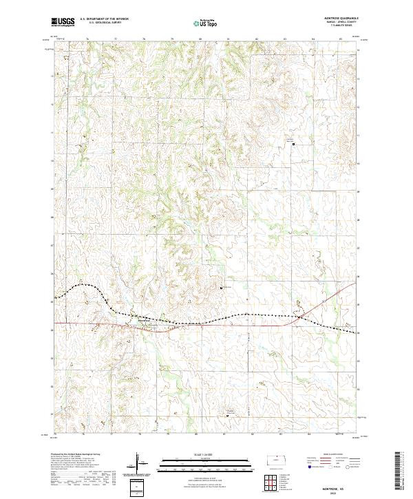
2022 Map of Montrose
USGS Topo · Published 2022About this map
Montrose serves as the central hub of this north-central Kansas landscape, where the agricultural grid meets the winding drainage basins of W Marsh Cr and E Marsh Cr. The terrain is defined by a dense network of sectional roads, including Randall Rd and S Ave, which connect remote homesteads to local centers of community and memory. Local genealogy is preserved in several rural burial grounds such as Switzers Gap Cem in the northeast and Pleasant View Cem near the southern border. The map also traces the delicate headwaters of Johns Cr and Spring Cr, illustrating how the upland topography directs water through the plains. This survey provides a modern view of the enduring land divisions established by the Public Land Survey System, marked here by the boundaries of t2s r7w and neighboring townships.
Find a feature on this map
19 named features on this map. Tap any name to fly to it.
Don’t see what you’re looking for? This feature index may not catch every label — zoom into the map to look around manually.
Map Details
Editions of this 2022 Montrose Map
This is the sole edition of this map. No revisions or reprints were ever made.
Other maps of this area

1892 · Concordia
USGS Topo · 1:125,000

1894 · Mankato
USGS Topo · 1:125,000

1955 · Manhattan
USGS Topo · 1:250,000

1955 · Beloit
USGS Topo · 1:250,000

1956 · Manhattan
USGS Topo · 1:250,000

1957 · Manhattan
USGS Topo · 1:250,000

1959 · Beloit
USGS Topo · 1:250,000
1968 · Jamestown NW
USGS Topo · 1:24,000
1969 · Randall
USGS Topo · 1:24,000

1969 · Mankato
USGS Topo · 1:24,000