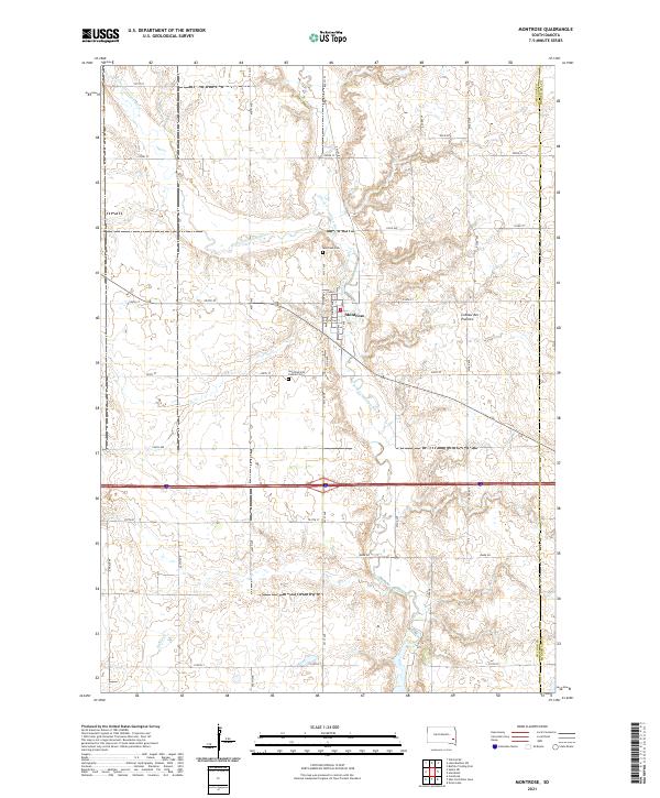
2021 Map of Montrose
USGS Topo · Published 2021About this map
The Montrose community serves as the primary focal point of this eastern South Dakota survey, situated where the Little Vermillion River joins the East Fork Vermillion River. The landscape is defined by the high glacial plateau of the Coteau des Prairies, which influences the drainage patterns of local waterways like Battle Cr. Notable landmarks for genealogical research include the Montrose Cem north of town and Saint Patrick's Catholic Cem located to the southwest. This area preserves a grid-based agricultural network across McCook and Minnehaha counties, intersected by major transit corridors including Interstate 90 and State Route 38. The map documents the persistent settlement patterns of this prairie region, showing the layout of residential streets such as Elder St and Kluckholm St in the heart of the village.
Find a feature on this map
29 named features on this map. Tap any name to fly to it.
Don’t see what you’re looking for? This feature index may not catch every label — zoom into the map to look around manually.
Map Details
Editions of this 2021 Montrose Map
This is the sole edition of this map. No revisions or reprints were ever made.
Other maps of this area

1955 · Sioux Falls
USGS Topo · 1:250,000

1958 · Sioux Falls
USGS Topo · 1:250,000

1964 · Montrose
USGS Topo · 1:24,000

1964 · Grass Lake
USGS Topo · 1:24,000

1964 · Canistota
USGS Topo · 1:24,000

1964 · Salem NE
USGS Topo · 1:24,000

1964 · Humboldt
USGS Topo · 1:24,000

1964 · East Vermillion Lake
USGS Topo · 1:24,000
1968 · Buffalo Trading Post
USGS Topo · 1:24,000

1968 · Lake Madison SW
USGS Topo · 1:24,000