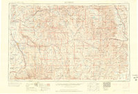
1960 Map of Montrose
USGS Topo · Published 1960About this map
The Continental Divide carves through this high-altitude landscape, separating the headwaters of the Arkansas River from the westward-flowing Gunnison River system. In 1960, the region’s mining heritage remains visible through settlements like Silverton, Ouray, and Telluride, while a uranium prospect hole reflects the era's mid-century energy pursuits. The Denver and Rio Grande Western RR follows the steep river valleys, a vital lifeline for the mountain towns and the agricultural hubs of Montrose and Delta in the Uncompahgre Valley. To the north, the dramatic topography of the Black Canyon of the Gunnison National Monument and the massive Grand Mesa dominate the horizon. This survey captures the Sawatch Range at its peak, identifying giants such as Mt Harvard and Mt Yale before modern recreational developments significantly altered these remote alpine corridors.
Find a feature on this map
214 named features on this map. Tap any name to fly to it.
Don’t see what you’re looking for? This feature index may not catch every label — zoom into the map to look around manually.
Map Details
Editions of this 1960 Montrose Map
2 editions found

Other maps of this area

1888 · Crested Butte
USGS Topo · 1:62,500

1888 · Anthracite
USGS Topo · 1:62,500

1889 · Crested Butte
USGS Topo · 1:62,500

1889 · Anthracite
USGS Topo · 1:62,500

1889 · Leadville
USGS Topo · 1:125,000

1891 · Leadville
USGS Topo · 1:125,000

1893 · Anthracite
USGS Topo · 1:62,500

1893 · Crested Butte
USGS Topo · 1:62,500

1893 · Aspen
USGS Topo · 1:62,500

1894 · Anthracite
USGS Topo · 1:62,500