
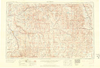
1960 Map of Montrose
USGS Topo · Published 1960About this map
The Gunnison River and its major forks dominate this mid-century portrait of West-Central Colorado, where high-altitude settlements follow the drainage basins of the Uncompahgre Valley and the San Luis Valley. The landscape is a complex network of public lands, including the Gunnison National Forest and the Uncompahgre National Forest, which surround mining and agricultural hubs like Gunnison and Ouray. Transportation in the era is defined by the Denver & Rio Grande Western RR and early mountain passages like State Route 149 and U.S. 50. Notable landmarks include the Black Canyon of the Gunnison National Monument and the dramatic spine of the Continental Divide. Smaller mining-related features, such as a Uranium prospect and the town of Bonanza, indicate the continued industrial interest in these mineral-rich ranges.
Find a feature on this map
165 named features on this map. Tap any name to fly to it.
Don’t see what you’re looking for? This feature index may not catch every label — zoom into the map to look around manually.
Map Details
Editions of this 1960 Montrose Map
2 editions found
Other maps of this area

1888 · Crested Butte
USGS Topo · 1:62,500

1888 · Anthracite
USGS Topo · 1:62,500

1889 · Crested Butte
USGS Topo · 1:62,500

1889 · Anthracite
USGS Topo · 1:62,500

1889 · Leadville
USGS Topo · 1:125,000

1891 · Leadville
USGS Topo · 1:125,000

1893 · Anthracite
USGS Topo · 1:62,500

1893 · Crested Butte
USGS Topo · 1:62,500

1893 · Aspen
USGS Topo · 1:62,500

1894 · Anthracite
USGS Topo · 1:62,500