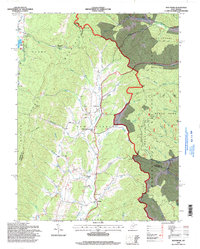
1995 Map of Montrose
USGS Topo · Published 1998About this map
Leading Creek carves a central valley through this landscape, serving as the primary corridor for the town of Montrose and the community at Smith Crossing. The topography is defined by the massive ridge of Laurel Mountain, which separates the more developed creek bottoms from the high, wooded reaches of the Monongahela National Forest. Within these forest boundaries, the terrain transitions into the steep slopes of Pheasant Mountain and Cheat Mountain, where narrow drainage runs like Panther Run and Haddix Run cut through the timberland. Rural life in the mid-1990s is anchored by local landmarks such as Israel Ch and Hart Chapel, while the presence of the Elkins Speedway near Kerens and a Strip Mine on the eastern edge of the quadrangle reflect the mix of recreational and industrial land use in the region.
Find a feature on this map
60 named features on this map. Tap any name to fly to it.
Don’t see what you’re looking for? This feature index may not catch every label — zoom into the map to look around manually.
Map Details
Editions of this 1995 Montrose Map
This is the sole edition of this map. No revisions or reprints were ever made.
Other maps of this area

1886 · St. George
USGS Topo · 1:125,000

1889 · Beverly
USGS Topo · 1:125,000

1891 · St. George
USGS Topo · 1:125,000

1892 · Beverly
USGS Topo · 1:125,000

1907 · Belington
USGS Topo · 1:62,500

1908 · Parsons
USGS Topo · 1:62,500

1909 · Elkins
USGS Topo · 1:62,500

1922 · Horton
USGS Topo · 1:48,000

1924 · Horton
USGS Topo · 1:62,500

1926 · Parsons
USGS Topo · 1:62,500