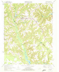
1968 Map of Montross
USGS Topo · Published 1972About this map
The town of Montross serves as a central hub on this Virginia coastal plain landscape, where the local economy and geography are defined by a complex network of swamps and millponds. To the north and west, Chandlers Millpond and Kenna Swamp feed into the broader drainage system, while the community at Zacata sits near the headwaters of Peirce Creek. The presence of educational institutions like Washington and Lee High Sch and Johnson High Sch highlights the mid-century social infrastructure of the Northern Neck region.
Find a feature on this map
72 named features on this map. Tap any name to fly to it.
Don’t see what you’re looking for? This feature index may not catch every label — zoom into the map to look around manually.
Map Details
Editions of this 1968 Montross Map
2 editions found
Other maps of this area

1892 · Piney Point
USGS Topo · 1:62,500

1892 · Montross
USGS Topo · 1:62,500

1894 · Piney Point
USGS Topo · 1:62,500

1895 · Nomini
USGS Topo · 1:125,000

1895 · Piney Point
USGS Topo · 1:62,500

1895 · Montross
USGS Topo · 1:62,500

1898 · Nomini
USGS Topo · 1:125,000

1901 · Piney Point
USGS Topo · 1:62,500

1917 · Morattico
USGS Topo · 1:62,500

1918 · Tappahannock
USGS Topo · 1:62,500