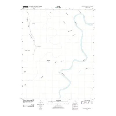
2010 Map of Monument Basin
USGS Topo · Published 2010About this map
Island In The Sky towers over the surrounding canyonlands, providing a dramatic vertical perspective on the winding course of the Colorado River. The landscape is defined by the sharp drop-off from the Murphy Range and Grand View Point down to the massive sandstone formations of Monument Basin. Within the basin, distinctive erosional features like The Totem Pole and Guillotine Arch stand as isolated landmarks against the backdrop of the White Rim bench. The intricate network of drainage is visible through named features such as Meander Canyon, Gooseberry Canyon, and Lathrop Canyon, which funnel toward the river. The map details the remote access provided by Grand View Point Rd, leading to the Buck Canyon Overlook where the topography breaks toward Sheep Bottom.
Find a feature on this map
20 named features on this map. Tap any name to fly to it.
Don’t see what you’re looking for? This feature index may not catch every label — zoom into the map to look around manually.
Map Details
Editions of this 2010 Monument Basin Map
This is the sole edition of this map. No revisions or reprints were ever made.
Other maps of this area

1885 · La Sal
USGS Topo · 1:250,000

1951 · Upheaval Dome
USGS Topo · 1:62,500

1952 · Carlisle 2 SE
USGS Topo · 1:24,000

1952 · Carlisle 2 NW
USGS Topo · 1:24,000

1952 · Carlisle 2 NE
USGS Topo · 1:24,000

1952 · Carlisle 2 SW
USGS Topo · 1:24,000

1953 · Carlisle 3 NW
USGS Topo · 1:24,000

1953 · The Needles
USGS Topo · 1:62,500

1954 · Carlisle 4 NW
USGS Topo · 1:24,000

1954 · Carlisle 1 NW
USGS Topo · 1:24,000